
Trace an Oregon Street Address
Follow one address through the records in the order they are kept. Oregon has no single statewide owner-name tax portal, so first identify the county and city that serve the property. A street directory search is strongest when each step confirms the same parcel rather than treating every name as a current occupant.
- Standardize and place it. Confirm the street form, unit, postal community, incorporated city, and county. Oregon's postal city can differ from the actual municipality, and a ZIP is not a city boundary.
- Find the parcel and owner of record. Search the county assessor by street address or parcel identifier. In Portland, PortlandMaps is the inspected local example; the state has no one-stop owner search.
- Check the map and legal description. Select the parcel in a local geographic information system (GIS) viewer, note its tax lot, the assessor's mapped parcel identifier, and neighboring geometry, then compare its situs address, the physical location, with the assessor record. A legal description is the recorded text that locates land by lot, block, survey, or similar reference.
- Follow recorded documents. Use that description or tax lot to find the current deed, then search the prior owner's name as the next link in the deed chain, the sequence of recorded transfers.
- Add dated household clues. Oregon My Vote checks one registrant by name and date of birth; it is not a streetwide list. Libraries' reverse directories can show an earlier occupant for a particular year.
Each source answers a narrower question than “who lives here?” The assessor names an owner, a permit may name an applicant or contractor, and a directory reports what was printed for its year. Keep those roles separate when you assemble the record trail.
PortlandMaps Fields for Oregon Addresses
PortlandMaps Advanced Assessor is a useful inspected example, not a statewide service. Every listed field is optional, but the search requires at least one term longer than one character overall. A percent sign can act as a wildcard, though it does not satisfy that minimum by itself. The form accepts address or property identifiers, and it can narrow results by neighborhood, city, ZIP, legal description, building details, sale date, and market value.
The PortlandMaps assessor search shows where these choices sit in the live form. Its field set is unusually rich, but another Oregon county may use different labels or expose fewer filters.
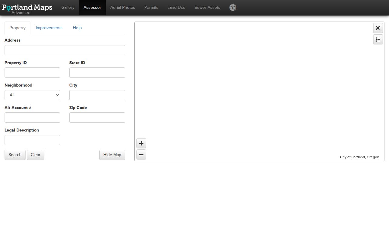
The screenshot illustrates a Portland property lookup. Results can be sorted by clicking column headers, paged with first, previous, next, and last controls, and downloaded as CSV, JSON, or XML.
| PortlandMaps field or control | Type and use | Requirement and notes |
|---|---|---|
| Address | Text; street or property search | Optional; exact or partial text, but one overall search term must be longer than one character. |
| Property ID | Text; local property identifier | Optional. |
| State ID | Text; state property identifier | Optional. |
| Neighborhood | Selector; city neighborhood | Optional; use the map or lookup when the neighborhood is unknown. |
| City | Text; city string | Optional. |
| Alt Account # | Text; alternate account identifier | Optional. |
| Zip Code | Text; ZIP filter | Optional; a search filter, not proof of municipal limits. |
| Legal Description | Text; parcel description | Optional; useful when a street address has changed. |
| Built in or after/before | Numeric or date-like text; improvement-age range | Optional. |
| Square footage greater than/less than | Numeric; improvement-size range | Optional. |
| Sold on or after/before | Date-like text; sale-date range | Optional. |
| Market value greater than/less than | Numeric; value range | Optional. |
| Second criteria group: City and Zip Code | Text; additional property/improvement filters | Optional. |
| Search, Clear, Hide Map | Buttons; run, reset, or toggle map | Search runs the query; Clear resets the form; Hide Map toggles the map. |
Records Tied to an Oregon Street
Several Oregon record systems use an address, parcel, or legal description, but each identifies a different relationship to the property. This coverage table helps keep an owner, a project contact, a voter, and a past directory entry from being mistaken for the same kind of evidence.
| Address record | Keeper | What it can show | Access route |
|---|---|---|---|
| Assessor or tax roll | County assessment and taxation office | Owner of record, situs and mailing address, tax lot, values, status, and improvement data | County portal, counter, or public-record request |
| GIS parcel layer | County, city, or state GIS | Parcel shape, tax lot, zoning, flood or service-district context | Local viewer or Oregon geospatial data |
| Deed, mortgage, or lien | County recorder or clerk | Parties, recording date, document number, legal description, and instrument | County index and images; counter or microform for older records |
| Plat or subdivision map | County recorder or surveyor | Recorded land plan showing lots, blocks, subdivision, easement (a right to use land), and mapped boundary | County recording or survey office; archives for older maps |
| Permit or code case | City or county planning and building office | Project address, applicant or contractor, status, inspection, and dates | Local permit viewer or records request |
| Tax-sale or foreclosure record | County treasurer, recorder, or court | Delinquency, notice, sale, judgment, or property tied to a particular year | County tax and court channels; coverage varies by year |
| Voter record | County elections officials through Oregon's system | Public registration fields at a residence address, subject to exclusions | My Vote for one person; regulated voter-list request for bulk data |
| Historical reverse directory | Library or archive | Past occupant or business at an address in a particular year | Library shelves or digitized collections; years and places vary |
A tax lot or legal description can connect the assessor record to a deed and a plat. Permit files add a project timeline, while a voter list or reverse directory adds a dated name clue. The Oregon Historical County Records Guide helps locate offices and older series when the online route ends.
Oregon Street Maps and Parcel Layers
Begin a map search with the address or intersection, then select the parcel itself. A geographic information system (GIS) map can expose the tax lot, jurisdiction, neighborhood or district, legal description, zoning, flood and service layers, and adjacent parcels. Layer names and detail vary by local viewer. Oregon geospatial data helps with statewide context, but the county assessor and recorder remain the sources for ownership and legal filings.
The PortlandMaps map and address viewer is the inspected example: a selected result can highlight a parcel and open an information panel. Some results have no associated point; double-clicking a result row opens its PortlandMaps record. Click nearby polygons one by one instead of assuming the closest street number touches the anchor parcel.
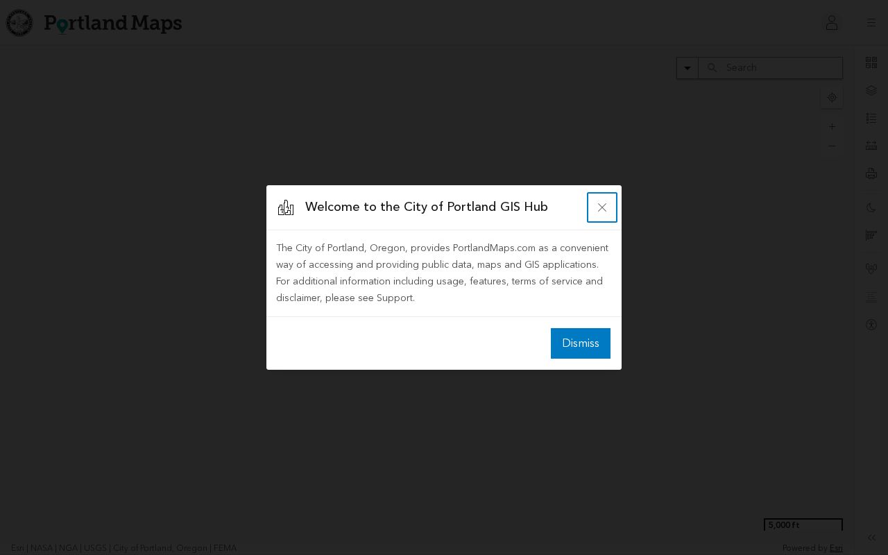
The map view is useful for orientation and parcel comparison. Confirm the boundary and ownership details in the county tax-lot or recording system, especially where a shared drive, condominium, easement, or water parcel sits between addresses.
Oregon Address Names and Jurisdictions
An Oregon address can carry several place names at once: postal community, incorporated city, unincorporated community, county, and assessor situs. The state's 2025 Address Point Standard says there is no seamless statewide address-point dataset; address points come from 241 incorporated cities, 36 counties, 9 tribes, and 6 regional councils of governments. The right office may therefore be a city department, county GIS or E911 office, tribal government, or regional agency.
Unit or subaddress data matters too. The standard makes a unit conditionally required because leaving out an apartment or suite can produce duplicate address points. The USPS ZIP Code Lookup can return unit ranges, but a postal community does not establish which municipal boundary contains a property. Oregon spatial data and local addressing records help reconcile those labels before a street directory search is treated as complete.
- Situs address
- The physical location assigned to a parcel or building.
- Mailing address
- Where tax notices or other mail are sent; it may be somewhere else.
- Parcel or tax lot
- A mapped unit used to connect land to assessor and recorder records.
- Legal description
- The text describing land by lot, block, survey, or other recorded reference.
These distinctions help with family research, property history, and civic questions. A mailing address can show an owner's contact choice, but it is not proof that the owner lives at the parcel.
Portland's 1933 Oregon Address Shift
Portland's address history is a special case in any Oregon street directory search. Crews began a citywide renumbering in 1931 and completed it in July 1933. Nearly every building number and directional changed, many street names changed, and the system created Portland's five quadrants. Some parts of southwest Portland were readdressed again in 2020 as South addresses.
The City Archives keeps a 1933 report with a two-way cross-reference between old and new addresses. Its street-renumbering record can bridge a current address to the form printed in an older directory or newspaper.
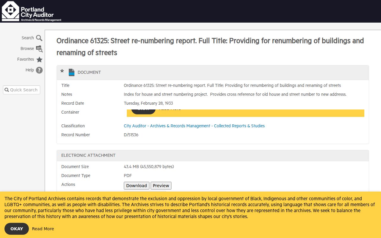
Use both address forms around the change rather than assuming a single conversion date for every neighborhood. Annexation also matters: a location now inside Portland may have sat outside city limits when an older directory or permit record was made.
Oregon Deeds by Legal Description
County recording systems preserve deeds, mortgages, liens, easements, plats, and other property-affecting documents. The address may be absent from an older index, so use the assessor's legal description or lot-and-block reference to find the matching instrument. Then follow the seller as the prior grantee to step backward through the deed chain. A grantor is the party transferring an interest; a grantee receives it.
Multnomah's online recorded-document search starts in February 2002. The county says older property records and recordings remain available through microform, an image copy kept on film, and the Public Research Room at the Multnomah Building, 501 SE Hawthorne Boulevard. The room is open weekdays from 8:30 a.m. to 4:30 p.m., except legal holidays, with a one-hour-per-person-per-day limit. A Combined Copy Request Form is available for older research and copies; fees follow the county schedule and ORS 205.320. Call or email the recording division to confirm where a series is held; mail, drop-box, and in-person copy routes are separate from the online search.
The MultcoRecords deed index shows the online search interface used for current recorded documents.
Its result descriptions include party names and types, document type and number, recording date, and legal description. Non-certified document images can be placed in an online cart; certified copies follow a separate route. The county's recorded-documents page explains coverage and the microform fallback.
Portland Permits by Oregon Address
PortlandMaps can connect an address to permits, land-use reviews, and code cases. A permit record may show work or case description, status, inspection activity, assigned staff, and available plan documents. The associated name may be an applicant, owner, or contractor, so it does not establish who occupied the property.
Portland permit documents are generally online for June 1, 2012 through December 2023. Many later documents are not yet online on the cited city page; material from before June 2012 and missing newer files requires a records request. The city's Permitting & Development records instructions list a minimum research fee of $8 per address, and additional fees may be estimated before work proceeds. Some documents may require an account.
For an older or missing file, follow the records-request route on Portland's Permitting & Development page or contact the relevant bureau. Other Oregon cities set their own online coverage and request rules, so Portland's dates and fee should not be applied statewide.
My Vote and Oregon Street Searches
Oregon My Vote is an individual lookup. It asks for first name, last name, and date of birth for a name search, with language choices and links to registration details, ballot status, county election offices, elected officials, and drop sites. It does not provide a streetwide roster.
A voter-list request is a separate, regulated route. Oregon's official voter-list specifications include residence-address fields, ZIP, precinct, status, party, and participation history, but not ballot choices. Any person may request a statewide or smaller electronic list; a statewide list costs $500, while a less-than-statewide request has a $25 setup fee plus 2.5 cents per 100 records, with a 10-business-day estimate. The request procedure gives the route and timing. Address Confidentiality Program participants are excluded, and commercial use is prohibited under ORS 247.955, subject to the law's political-resale exception.
A street-by-street search should not turn those fields into a published block list. People who are exempt or not registered will not appear, and registration does not prove current occupancy. Contact the county elections office for correction procedures when a record appears stale.
Oregon Street Guides Through Time
Portland's directories from 1930 onward include a reverse Street and Avenue Guide arranged by street, block, and address. The entry is abbreviated and identifies who or what was listed at that address for that year. Use its matching alphabetic section to interpret the name, business, or notation. Multnomah County Library's Portland directory research guide explains the shelf and the address-change cautions.
For years before 1930, start from a known person's name and search backward. Rural route addresses need a different key: the library's East-of-I-205 guide documents Gresham and East Suburban address directories, while Tscheu volumes use route boxes rather than today's street numbers. Other Oregon towns may have name-only runs or irregular years. The Oregon city directory collections page covers those historical holdings in more depth.
Use a directory as a dated record, not a live resident list. It can help reconnect a family address to a past occupant, but its year, geography, and abbreviations all shape what a search can find.
What an Oregon Street Directory Cannot Show
Public parcel records name owners, not every person inside a building. A voter record may identify a registrant, and a permit may name someone tied to a project, but neither is a complete household record. Utility customer names, delivery recipients, and DMV addresses are not public street-search sources; the federal Driver's Privacy Protection Act limits DMV disclosure.
Use the evidence for personal research, family history, and civic understanding. Do not publish private household lists or use address records to watch, pressure, or harass people. When a record raises a serious question, confirm it with the office that holds the source document.
Lawful use. Oregon address records support personal, lawful research. Do not use the information to stalk, threaten, or harass any person.
- Plat
- A recorded map that lays out parcels, lots, blocks, or easements.
- Criss-cross directory
- A historical directory arranged by address or street rather than only by a person's name.
- Mailing address
- A destination for notices or bills, which may not be the property's situs.