
Oregon ZIP Code Coverage by Region
The Oregon Address Point Standard reports 479 ZIP Codes, all beginning with 97. Its reference table is the complete statewide source; the regional groupings below describe where those ranges are represented, not an exact count or a list of every active code. Individual postal names and ZIP types should be checked against current USPS results.
| ZIP range | Areas Covered | Post office | Notes |
|---|---|---|---|
| 97001 to 97089 | Portland region, north Willamette Valley, Columbia Gorge and nearby rural communities | Multiple postal communities; verify the exact office name | Standard, PO Box Only and Unique types occur in this group. |
| 97101 to 97149 | North Coast, Yamhill area, west-side suburbs and nearby rural communities | Multiple postal communities; verify with USPS | Some communities share postal names or use PO box service. |
| 97201 to 97298 | Portland, Milwaukie, Oak Grove and Tigard alternate postal names | Portland-area offices; verify the address result | Includes standard, PO box and unique institutional patterns. |
| 97301 to 97396 | Salem and Keizer, Mid-Valley, coast and rural post offices | Multiple postal communities; verify with USPS | Postal names can differ from city limits. |
| 97401 to 97499 | Eugene and Springfield, Lane County, South Coast and rural communities | Multiple postal communities; verify with USPS | Alternate postal names and PO box service appear in the region. |
| 97501 to 97540 | Medford, Ashland, Jackson County and Rogue Valley communities | Multiple postal communities; verify with USPS | Delivery areas do not necessarily follow city lines. |
| 97601 to 97999 | Klamath and eastern Oregon, central Oregon, Pendleton, Umatilla, Ontario and remote communities | Multiple postal communities; verify with USPS | Use a current lookup for the preferred name and active status. |
These broad groups keep the Oregon ZIP code directory useful without assigning a town to an individual code where the research gives only regional coverage. The full official table lists each postal code, preferred and alternate community names, and ZIP type. Check that table or USPS for a specific address rather than reading a row here as a boundary map.
Oregon ZIP Types and Counts
Oregon's standard divides ZIPs into three delivery types. A STANDARD ZIP serves street delivery. A PO BOX ONLY ZIP is tied to post-office boxes rather than ordinary street delivery. A UNIQUE ZIP is assigned to a large commercial or government shipper. These labels describe postal service, not how many residents or neighborhoods a code contains.
The 479-code figure is statewide; the research did not locate a statewide count of residents by ZIP or exact ZIP-by-ZIP population distribution. The standard's Appendix D contains the underlying postal-code table on pages 48 to 56. It is a better reference for code type and postal community than a homemade count by region.
Oregon uses more than one address geography. A street address may be assigned by a city, county, tribe or regional government, while USPS maintains the delivery name and ZIP. Some real ground addresses do not receive street delivery; the state's standard names Sunriver as an example where the mailing address may instead be a PO box.
Oregon ZIP Codes Cross City Lines
A postal city name is a routing label, not a finding that the address sits inside that incorporated city's boundary. The state's standard documents several Oregon overlaps. ZIP 97015 can use Clackamas, Damascus or Happy Valley; 97086 can use Happy Valley, Clackamas or Portland. In the Portland area, 97222 and 97267 include Portland, Milwaukie or Oak Grove names, while 97223 and 97224 can use Portland, Tigard or King City.
The same pattern appears elsewhere. ZIP 97303 can use Salem or Keizer, and 97408 can use Eugene or Coburg. These examples are postal-name overlaps, not a complete boundary list. A county, city or school district may use a different line for its own records. For a parcel, confirm the taxing jurisdiction and situs address with the local assessor; for a delivery address, use USPS.
A ZIP search can therefore return records tied to a postal community that is not the legal city name. Keep the postal city in one field and the incorporated municipality in another when comparing records. This avoids treating an alternate city name as a change of ownership or a move.
Finding Oregon Residents by ZIP Code
There is no official Oregon resident roll organized statewide by ZIP. Some local assessor systems accept a ZIP filter; voter-list specifications include residence and mailing ZIP fields, but getting that data requires a formal list request rather than a free neighborhood search. Use a ZIP to narrow a question, then confirm the result through the record keeper that owns it.
- Confirm the postal code and preferred city name with USPS for the full address.
- Check the county assessor or parcel viewer. Owner-name search and ZIP filters vary by county; PortlandMaps is the inspected local example.
- For an election record, use My Vote for an individual name and date of birth. A statewide voter-list request is separate, costs $500 electronically, normally takes 10 business days and cannot include Address Confidentiality Program participants.
- Compare the result with a second official source, such as a deed, court index or business filing, and note what each record confirms.
After a ZIP search points to a street, the Oregon street directory explains the address-level record trail. A ZIP by itself cannot confirm that a person lives at a parcel or that a postal city matches its municipal jurisdiction.
Oregon USPS ZIP Lookup Modes
The USPS lookup has three useful paths, depending on what is known. Use the address mode for one delivery point, city and state when the postal name is the question, or cities by ZIP to see the names USPS associates with a code.
| Lookup mode | Input | What to check |
|---|---|---|
| By Address | Street address with city and state, or street address with ZIP | Standardized address, ZIP+4, delivery-point validation and unit range when shown. |
| By City and State | City and state | Postal names associated with that city and the available ZIPs. |
| Cities by ZIP Code | ZIP Code | Postal communities associated with the code. |
Open the USPS ZIP Code Lookup to see the official address, city/state and cities-by-ZIP options.
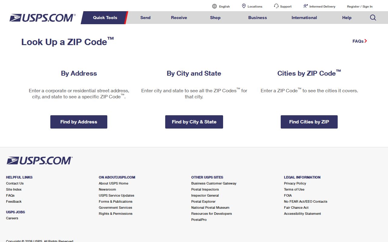
The USPS result can standardize an address and show ZIP+4 or DPV details, but USPS warns that a match does not prove a person or business is at that address. Postmaster Finder serves a different purpose: it may show establishment or discontinuance history for a three-digit area and is not the current-address tool.
PortlandMaps Oregon ZIP Filters
PortlandMaps Advanced Assessor is a concrete Oregon example of a local property search with a ZIP field. It also supports address, property ID, State ID, neighborhood, city, alternate account, legal description, building-age, square-footage, sale-date and market-value filters. This is a Portland-area portal, not proof that every county assessor offers the same search options.
| Field or control | Type | Use and limits |
|---|---|---|
| Address | Text | Optional; one search term can be enough. |
| Property ID / State ID | Text | Local and state property identifiers. |
| Neighborhood / City | Select / text | Choose a city neighborhood or enter a city string. |
| Alt Account # | Text | Alternate account identifier. |
| Zip Code | Text | Filters local property results; it does not define a municipal boundary. |
| Legal Description | Text | Searches legal-description text. |
| Built, size, sale and value | Range fields | Optional building-age, square-footage, sale-date and market-value criteria. |
| Second criteria group | Text | Also accepts City and Zip Code. |
| Search / Clear / Hide Map | Buttons | Run or clear a search and toggle the map display. |
At least one search term must be longer than one character; a percent sign may be used as a wildcard and does not count toward that length. Result columns can be sorted, pages can be moved, and the result set can be downloaded as CSV, JSON or XML. A result row can map a parcel, though some records have no associated point.
Use a PortlandMaps ZIP result as an owner-and-parcel lead. It does not supply an Oregon-wide list of residents, and a mailing address can differ from the parcel's situs address.
ZIP Terms and Oregon City Limits
A ZIP code is a postal delivery area. It is not a census block, a resident list, a parcel boundary or a city-limit polygon. Keep that distinction in mind when a county or city portal uses the same five-digit value for a local filter.
- ZIP and ZIP+4
- The five-digit code identifies a postal area. The added four digits can narrow delivery to a segment, building or group of delivery points.
- PO Box Only ZIP
- A code used for post-office box service rather than ordinary street delivery.
- Unique ZIP
- A code reserved for a large commercial or government mail recipient.
- Carrier route
- A USPS delivery-route grouping within a postal operation. It is not a separate city boundary or a statewide resident-search index.
Use USPS for current postal assignment, then use the local address authority and assessor for jurisdiction or parcel questions. That two-step check is the reliable way to read a ZIP without turning a mail label into a claim about who lives there.